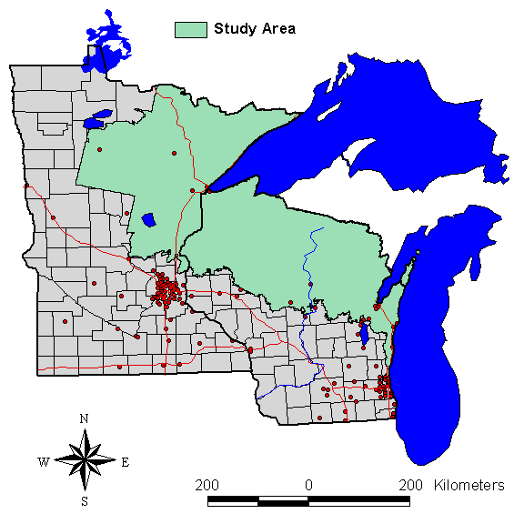
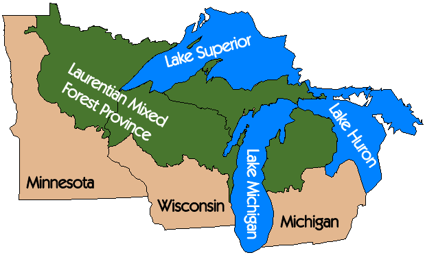
Great Lakes Interactive MapServer
Laurentian Mixed Forest Province GIS layer courtesy North Central Research Station, US Forest Service. US states and Great Lakes GIS layers from ArcView data, ESRI