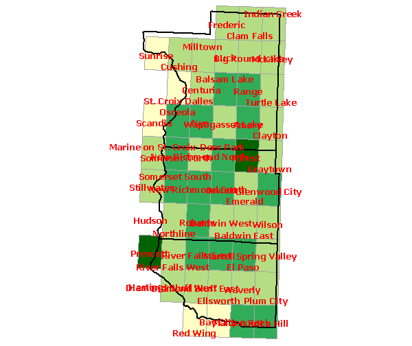
Region 9 - Total Species
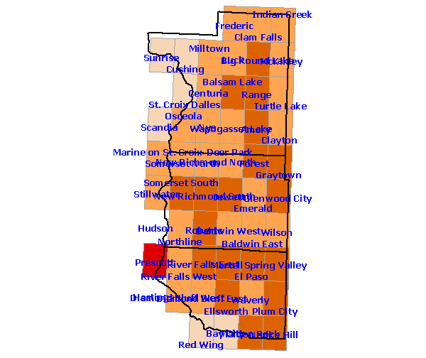
Region 9 - Confirmed Species
ArcView GIS software courtesy ESRI Conservation Program.
GIS layers courtesy Wisconsin Department of Natural Resources.
Last Edit Date: May 5, 2003
Main Page
|
Project Purpose
|
About this Site
|
Staff
|
Coordinators
|
Atlasers
|
Contributors
Survey Areas
|
Breeding Codes
|
Habitat Codes
|
Abundance
|
Atlas Projects
|
Bird Monitoring Projects
Tally Data
|
State Maps
|
Region Maps
|
Species Maps
|
Species Lists
|
Image Library
|
Audio Library