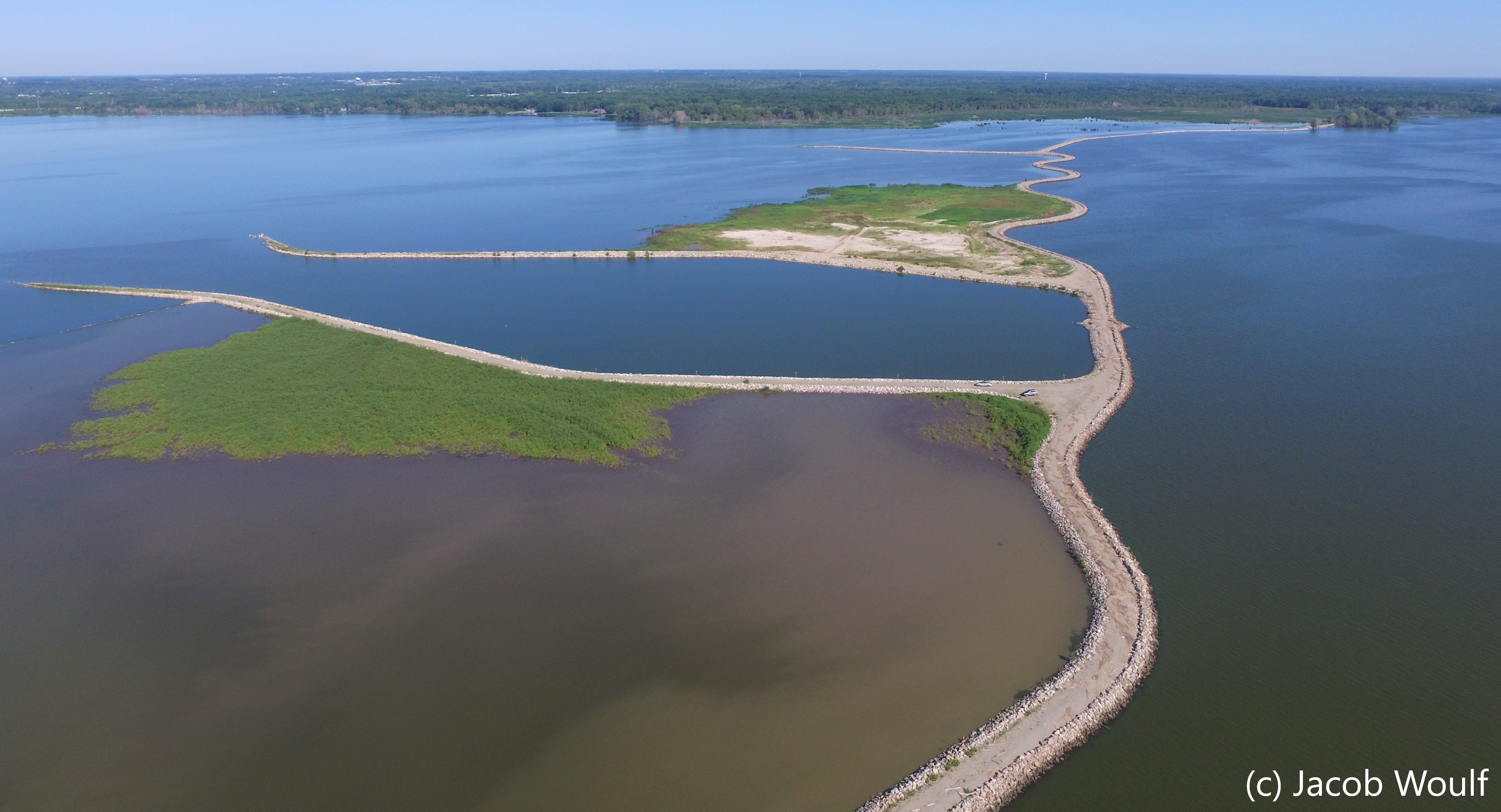
Cat Island Restoration

History
Historically, there were three large barrier islands (called the "Cat Island Chain") that provided critical fish and wildlife habitat for birds, fish, invertebrates, and mammals as well as refugia of native plants and extensive Great Lakes beach. These islands also protected a massive complex of emergent and submergent marshes in the Duck Creek Delta. However, due to extremely high water levels in the bay, massive storms, and recently hardened shorelines (e.g., development), these islands washed away during the spring of 1973 with the exception of a few small sandy islands, including Cat Island. The Duck Creek Delta marsh complex also vanished because the islands no longer provided the much needed protection and due to high sediment loads further upstream. Despite the high water and storms, remnants of Cat Island and a few other tiny islands persisted and are still present today.

Cat Island Restoration Project
In the 1980s, a group of local conservationists proposed the idea of reconstructing these three barrier islands and formalized the idea in the Lower Green Bay and Fox River Area of Concern’s 1988 Remedial Action Plan. It took decades for that idea to materialize and became a reality, but it finally happened. Conservationists collaborated with Brown County, Brown County Port and Resource Recovery Office, and U.S. Army Corps of Engineers (USACE) and decided to reconstruct these islands. The goals were to restore the loss of island fish and wildlife habitat, provide protection from wave action to restore the Duck Creek Delta marsh complex, and provide the Port of Green Bay with more storage for shipping channel dredge material.
The Cat Island Wave Barrier and island “cells” were eventually constructed by May 2013. A total of $19.3 million in funding for this project has been provided by the USACE, Wisconsin Department of Transportation, Great Lakes Restoration Initiative, Brown County, Natural Resources Damage Assessment, and Port Terminal Operators. On-going funding from the USACE, U.S. Fish and Wildlife Service and WI Department of Natural Resources and grants is used for managing the islands. Aside from those listed above, many other partners have been involved in this project, including UW-Sea Grant, UW-Green Bay, Lower Fox River/Green Bay Natural Resources Trustee Council, Audubon Great Lakes, and many port terminal operators. A few times a year, the Cat Island Advisory Committee meets to discuss dredging updates, habitat and wildlife management, research, and other topics with the USACE, Brown County, and others. The Cat Island Restoration Project will not be fully completed for another 20-30 years, though many fish and wildlife have already been documented using the relatively new dredge material and recently formed wetland habitat. This project serves as a large-scale, collaborative, adaptive project that is ever-changing.


Cofrin Center for Biodiversity's Involvement
Staff and faculty from the Cofrin Center for Biodiversity (CCB) have actively been involved as a partner in the Cat Island Restoration Project since the early 2010s and regularly participates in Cat Island Advisory Committee and habitat restoration meetings. Over the past decade, the CCB has been involved in monitoring and research projects on the causeway, including endangered species monitoring (e.g., Piping Plover [Charadrius melodus]), Great Lakes Coastal Wetland Monitoring Program bird and anuran surveys, lower bay submerged aquatic plant surveys and habitat mapping, and documenting piscivorous birds (i.e., fish-eating birds). Research led by CCB graduate students for their master's theses have played pivotal roles in what is known about Brown County migratory shorebirds (Tom Prestby), nesting Piping Plovers (Demetri Lafkas), and piscivorous birds (Jacob Woulf and Brandon Byrne).
Reference Materials
- Cat Island project website
- Cat Island project overview / history slideshow
- Cat Island Management Plan
- Cat Island Chain Background and Access Guide
- Cat Island Operation and Maintenance Manual
- Cat Island mapping tool (Ducks Unlimited)
- 1845 head of lower Green Bay map
- Cat Island overview document (UW-Green Bay)