History & Resources
A Storied Past
Learn the history to lead way for the future.
Prior to European colonization, the Lower Green Bay consisted of large beds of wild rice and wild celery, extensive emergent marsh, sedge meadows, shrub carr, swamps and wet conifer forest. Three barrier islands provided habitat for fish and wildlife, but those were largely washed away due to extremely high water levels and intense storms. Environmental challenges began because of human action. With human action, we can also address environmental challenges.
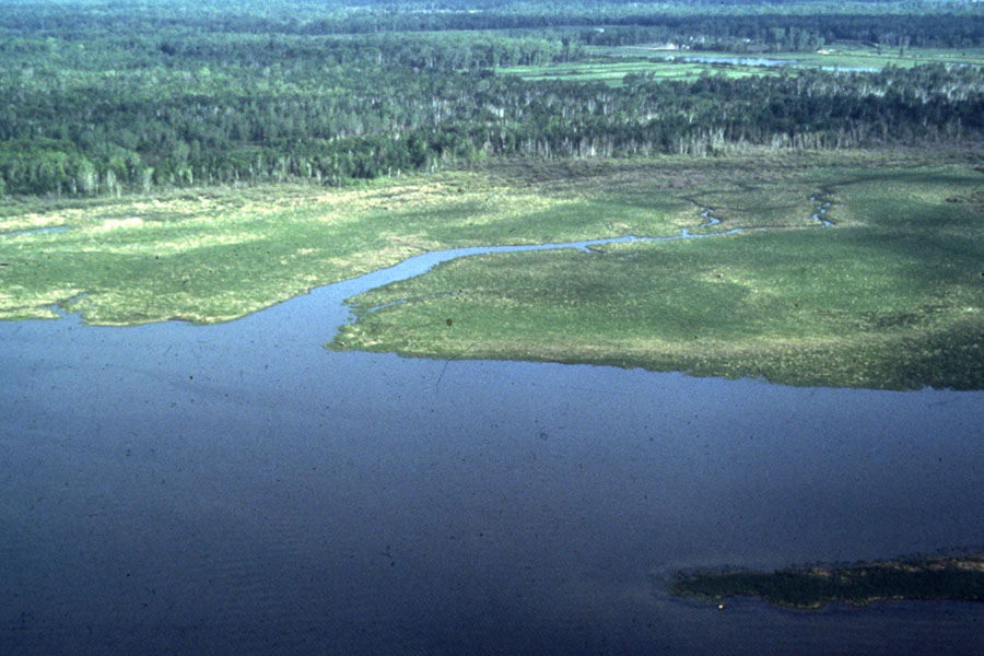
See the Land Across Time
Through historical data, we can better understand environmental challenges of the LGBFR AOC.
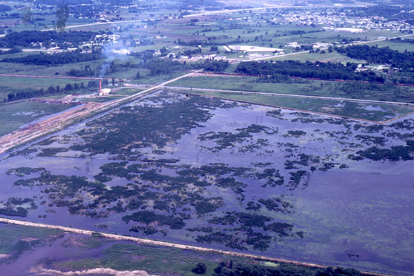
Map & Photo Collections
View a range of important historical information of our region throughout the years.
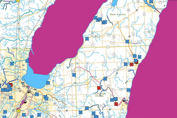
Surface Water Data
Get access to interactive web mapping tools for a wide variety of datasets including chemistry, physical and biological data.
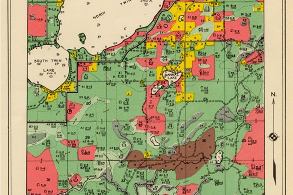
1945 Bordner Surveys
This project produced detailed, field-based maps with over 100 classes, including the types of crops grown, and the species, density, and diameter of trees.
Other Resources
- Wisconsin Dept. of Natural Resources: Lower Green Bay & Fox River AOC: more detailed information on the Lower Green Bay and Fox River Area of Concern.
- U.S. Environmental Protection Agency: Lower Green Bay & Fox River AOC: general information on the Lower Green Bay and Fox River Area of Concern.
- Clean Bay Backers: Citizen Advisory Committee to the Wisconsin Dept. of Natural Resources for the Lower Green Bay and Fox River Area of Concern.
- The Nature Conservancy's Freshwater Network GIS Tool: click "Go" next to "Wildlife Recovery: Lower Green Bay & Fox River AOC" to learn about fish passage barriers, potentially restorable wetlands and more.
- Story Map of the Lower Fox River/Green Bay Watershed: story maps depicting the dynamic story of conservation within the Lower Fox River and Green Bay watershed
- Lower Green Bay West Shore Habitat Management & Restoration Plan: report/restoration plan and accompanying GIS map of potential habitat management activities to be done in the lower bay/west shore area of Green Bay.
- FEMA Coastal Flood Study: Great Lakes Coastal Flood Study website for FEMA's storm and wind study of the Great Lakes basin
- FEMA Coastal Flood Study Downloads: technical resources for FEMA's study of the Great Lakes basin including a photo viewer from the U.S. Army Corps of Engineers along with past studies and surveys.
Ask an Expert
As a proud alumna of UW-Green Bay, Erin Giese understands the need to provide hands-on experiences for students. She's committed to training the next generation of scientists who help to improve the LGBFR AOC. If you have questions, she can help!